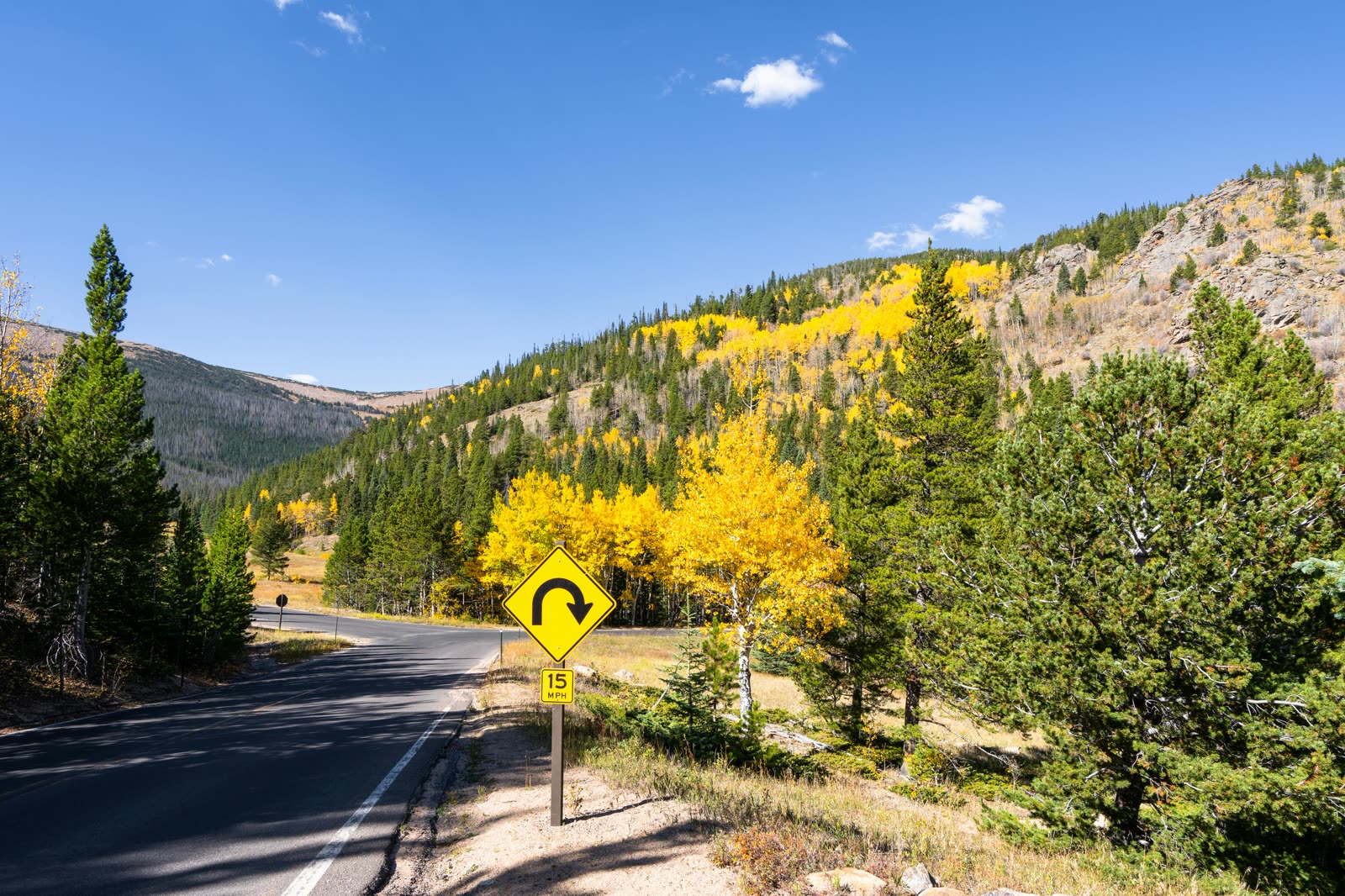
The most beautiful drive in Colorado runs twenty-two miles east from Aspen, climbing five thousand vertical feet to a summit on the Continental Divide before dropping down the other side to the old mining town of Twin Lakes. Highway 82 — known locally as Independence Pass — is open for roughly six months a year, paved the whole way, free to drive, and almost entirely unknown to first-time Aspen visitors who never venture east of town.
The Pass is older than Aspen itself. The original wagon route over the Continental Divide opened in 1881 to connect the new silver-mining boomtown of Aspen to the railhead at Leadville, and the route was so brutal — narrow, exposed, snowbound for nine months a year — that mining ore was shuttled across the Pass in segments of pack-mule, stagecoach, and freight wagon. The modern paved highway largely follows the same alignment, with the same sequence of switchbacks and the same blunt confrontation with the alpine landscape. It closes every fall (usually around November 1) and reopens every spring (typically Memorial Day weekend, sometimes a week or two later if snowpack is heavy). Within that summer window it is one of the great free experiences of any Aspen trip.
What follows is the drive itself, mile by mile, with the worthwhile stops and a sense of what to expect at each.
The Basics.
- Season Memorial Day weekend (late May) through approximately November 1, weather dependent. The Pass closes when the first significant snowstorm makes it dangerous. There is no fixed closing date; locals watch the forecast and the CDOT closure announcements through October.
- The drive itself Twenty-two miles from downtown Aspen to the summit (12,095 ft). Allow 45 minutes one-way if you do not stop, two to three hours if you stop at the major sites. Continuing down to Twin Lakes adds another 20 miles and 40 minutes.
- Vehicle restrictions No vehicles or trailers over 35 feet are allowed on the Pass — the hairpins are too tight. RVs, large trucks with trailers, and any combination above 35 ft will be turned back. A normal car, SUV, or van is fine.
- Free · No reservations Unlike the Maroon Bells, the Pass requires no entry fee, no reservation, no shuttle. Park at any pullout. Most stops have small dirt lots.
- Weather caution Above 11,000 ft, the weather can change in minutes — sunny morning to snow squall by 2 PM is common in July. Carry a jacket, water, and snacks even on warm days. Cell service is patchy above 9,000 ft.
The Drive, Mile by Mile.
Set the trip odometer at the Highway 82 roundabout east of downtown. The road follows the Roaring Fork River for the first ten miles, then begins climbing in earnest through a series of switchbacks until it crosses the Continental Divide at the summit. The major stops:
- Mile 4 · Difficult Creek Campground A small Forest Service campground with creek access. First-come walk-up sites in summer. The creek itself is one of the easier kid-friendly water spots near Aspen.
- Mile 6 · Weller Lake Trailhead A one-mile round-trip walk to a small alpine lake tucked into a pine grove. Easy with kids. Trailhead pullout on the right (south) side.
- Mile 8 · The Grottos The most-visited stop on the entire Pass. A short trail loop accesses granite slabs sculpted by glaciers, small waterfalls, and ice caves carved by Roaring Fork meltwater. Free, no permits, family-friendly. Most visitors reach the caves within ten minutes of leaving the car. Parking lot fills by mid-morning on summer weekends — go early. (Detailed in our Free in Aspen guide.)
- Mile 11 · Lincoln Creek Road A rough dirt 4WD-only side road heading south to Grizzly Reservoir and (much farther) the ghost town of Ruby. Don't attempt in a passenger car. With high-clearance 4WD, the reservoir is a stunning quiet alpine destination 7 miles up the road.
- Mile 14 · Mountain Boy Park A small meadow pullout with views of unnamed peaks; nice picnic stop with restrooms. The road begins seriously climbing here.
- Mile 16 · Devil's Punchbowl Beloved local swimming hole — but only for the brave. A small pool of glacier-cold water at the bottom of a 30-foot cliff jump. Locals (and a steady stream of nervous tourists) jump from the bridge above. Park at the pullout, walk down to the river. The water is genuinely cold; the jump is genuinely high. Most visitors look, don't jump. The pullout is small and fills early.
- Mile 18 · Independence Ghost Town A preserved 1880s silver-mining settlement, abandoned by 1899 when the silver crashed and surviving miners walked out over the Pass in the middle of winter. The Aspen Historical Society maintains interpretive signage at the site. About a dozen log structures remain, in various states of collapse. Open daily in summer, free. Combine with a stop at the Independence trailhead a half-mile farther.
- Mile 20 · Linkins Lake & Lost Man trailheads Two of the great alpine hike starts in the Aspen area. Linkins Lake is a 1.5-mile climb to a high tarn surrounded by tundra; Lost Man Lake is a longer 7-mile round-trip to a wilderness lake. Both above 11,000 ft. Day-1 acclimatization not recommended; better as a day-3 hike.
- Mile 22 · The Summit · 12,095 ft The top of the Pass, on the Continental Divide. Parking lot, a small interpretive area, and a short paved walk to the overlook. Cold and windy even in July (40s°F is normal; below freezing if a storm is moving in). Spectacular 360-degree views of the Sawatch and Elk Mountain ranges. From here, water on the east side flows toward the Mississippi and water on the west side flows toward the Pacific.
Continuing Down to Twin Lakes.
If you keep driving east from the summit, the road descends 20 miles to the small lakeside town of Twin Lakes — population 75 in winter, several hundred in summer, with two restaurants, a general store, and a row of historic mining-era cabins. The road from the summit down is even more dramatic than the climb up: a series of switchbacks through alpine tundra, then aspen forest, with the twin alpine lakes themselves visible from a thousand feet above. Twin Lakes is a worthwhile lunch stop (the Twin Lakes Roadhouse has decent burgers; the general store sells coffee and ice cream). From Twin Lakes you can continue another 16 miles to Leadville — the highest incorporated town in the United States at 10,152 ft, with a preserved mining history downtown.
The full Aspen-to-Leadville-and-back day is a stretching but rewarding loop: 78 miles round-trip, roughly four hours of driving, plus stops. Most visitors who drive the Pass do not continue past Twin Lakes; the summit and the back-down is plenty for a half-day.
What to Bring.
- Water · more than you think 2 liters per adult for a half-day drive with stops. The altitude dehydrates faster than the temperature suggests.
- Layers It is 40°F at the summit on a 75°F day in Aspen. Always pack a jacket and a hat.
- Sunscreen and sunglasses At 12,000 ft, UV is roughly 50% stronger than at sea level. Bright snowfields above timberline reflect even more.
- Snacks or a picnic No services between Aspen and Twin Lakes. Pack lunch from Paradise Bakery or the deli at Clark's Market in Aspen.
- A full tank No gas stations on the Pass. Fill up in Aspen before going.
- An emergency kit if going late season October drives can be sunny-with-snow within an hour. Carry blankets, a flashlight, and water in case of a closure or delay.
When to Go.
The best wildflower window on the Pass is roughly the first two weeks of July, when the alpine meadows above timberline burst into bloom for a brief two-week peak. The best fall-color window is mid-to-late September, when the aspen groves between Aspen and mile 12 turn solid gold. Outside of those two windows, the Pass is consistently good throughout summer; the August window can be hazier from western-state wildfires but is otherwise unchanged. Early mornings (8 to 10 AM) are the best for both light and crowds. The Grottos parking lot is the only consistent bottleneck — go before 10 AM in July and August.
One last note: the Pass closes earlier in the season than most visitors expect. Late October is genuinely a coin flip. Always check the Colorado Department of Transportation (cotrip.org) for live closure status if traveling in the shoulder months.